The U.S. is spending $1 million to mitigate landslides on the rise
In a bid to prevent loss of life and minimize economic damages, the United States Geological Survey (USGS) has awarded grants worth $1 million to various states across the country to address the growing threat of landslides. The grant will be used to fund landslide mitigation projects in Arizona, Colorado, Georgia, Indiana, Kentucky, North Carolina, North Dakota, Oregon, Utah, and Washington.
One of the major recipients is the Utah Geological Survey, which has been allocated $302,494 to create a landslide inventory map for mountain area valleys along the Wasatch Front. The project aims to identify high-risk areas in regions where urban housing is growing in foothill and lower mountain canyon areas. This initiative is crucial as Utah has experienced above-normal snowpack levels in recent years, increasing the potential for landslides.
The grant will also fund an early warning system for flash floods and debris flows, which will enable authorities to respond quickly during emergencies. Additionally, it will support procedures for sending government scientists, equipment, and services to landslide areas during disasters.
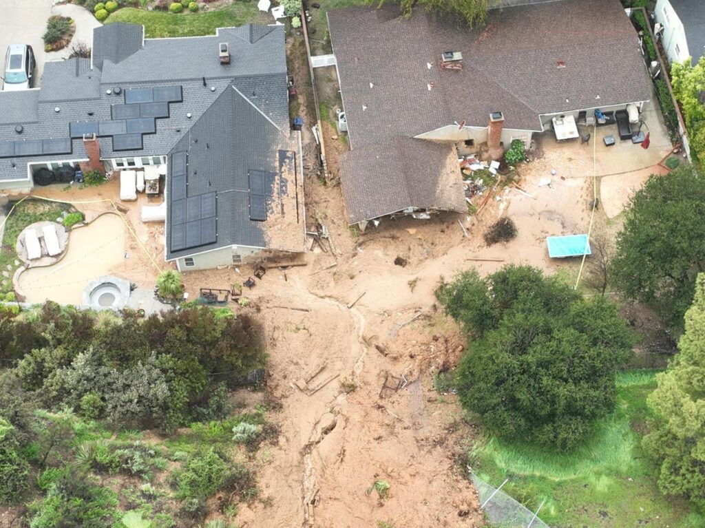
The growing concern about landslides is underscored by the statistics provided by FEMA. According to the agency, over 100 people have lost their lives in California alone due to landslide-related flowing debris since 1995. This highlights the need for greater preparedness and mitigation measures.
It’s worth noting that Utah has a history of devastating landslides. In recent years, the state has seen numerous events, including one in 2014 that resulted in $2 million in damages. The grant will provide critical funding to help prevent such disasters.
The USGS grants are part of a broader effort to reduce the impact of landslides, which have become increasingly common due to climate change and extreme weather events.
Source: www.forbes.com